Layer Larks Consulting Group is dedicated to helping you fulfill your consulting needs within the remote sensing industry. We can assist you with the interpretation and measurement of physical, biological and cultural features, spectral signatures, image classification, and more. The opportunities are endless. See some of our past projects below.
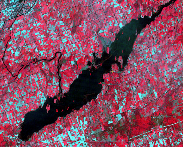
Geometrically corrected Standard False Color Landsat 5 TM image of Rice Lake, Ontario, with the roads overlain (as black vectors). The Image is from June 12, 1992.
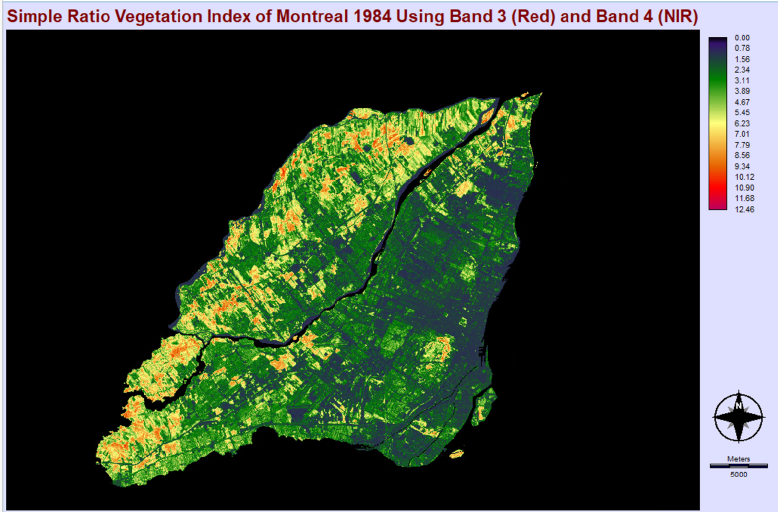
Montreal Vegetation distribution, highlighting areas with varying levels of greenery based on the absorption of red light and near-infrared scattering. The Simple Ratio (SR) method assesses vegetation by appraising red band light absorption and near-infrared scattering, mitigating the impact of terrain and atmosphere. SR = NIR / Red
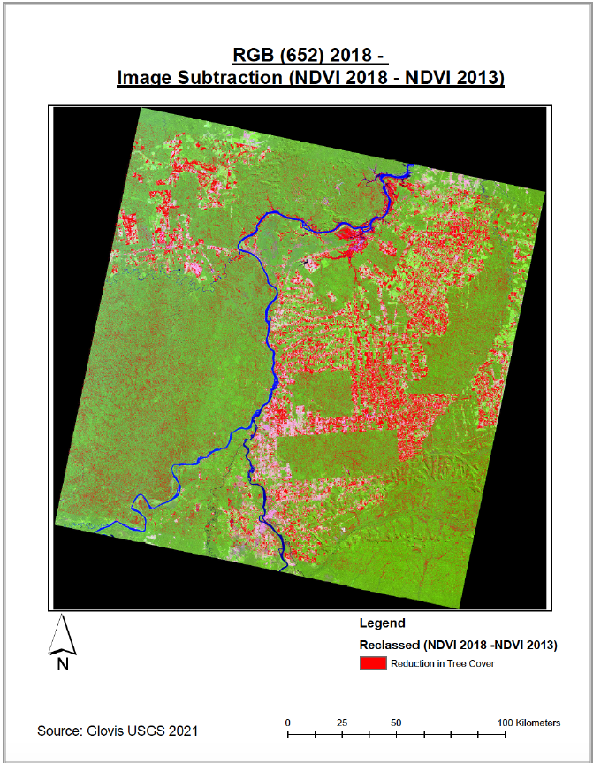
The red areas on the map show where there was a reduction in tree cover between 2013 and 2018.